Ireland's Most Trusted Drone Survey Experts
From construction surveys to thermal solar inspections — precision aerial data delivered by Cork's leading EASA-certified drone team. 500+ projects. 8+ years.
What We Do
Professional Drone Services for Every Industry
From construction to coastal surveys, our certified pilots deliver precise, insured aerial data across Ireland.
How It Works
Simple 3-Step Process
From initial enquiry to data delivery — straightforward, professional, and always on time.
Free Consultation
Tell us your project goals. We'll assess site requirements, airspace, and plan your survey in detail.
EASA-Compliant Flight
Our certified pilots execute the survey using DJI Enterprise and Trimble GNSS equipment.
Data Delivery
Processed outputs, 3D models, thermal reports, or edited footage — delivered within 48 hours.

Why Choose Us
Cork's Most Qualified Drone Team — Period.
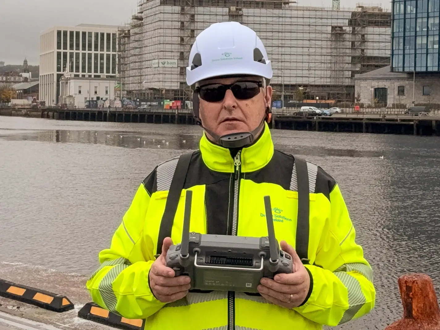
Richard Coleman and the Drone Solutions Ireland team combine 8+ years of operational expertise with the highest level of EASA certification and enterprise-grade DJI equipment.
EASA STS-01 & STS-02 Certified
Authorised for complex urban and controlled airspace operations.
DJI Enterprise Authorised Partner
Matrice 4T, Mavic 3 Enterprise, and Zenmuse P1 for every application.
48-Hour Data Turnaround
Processed reports, models, and footage delivered with industry-leading speed.
€6.5M Public Liability Insurance
Fully covered for all commercial and industrial environments.
Our Work
Featured Projects

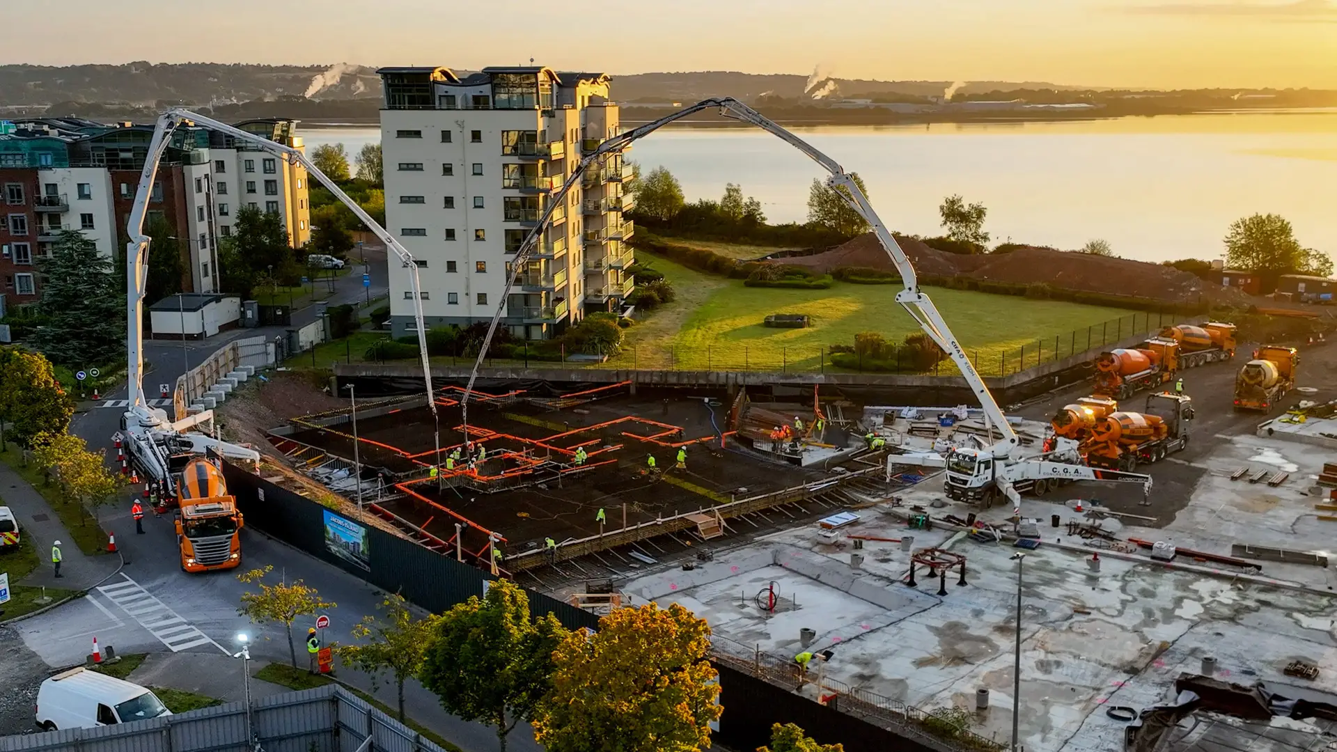
Port of Cork Survey
Residential Construction Mapping

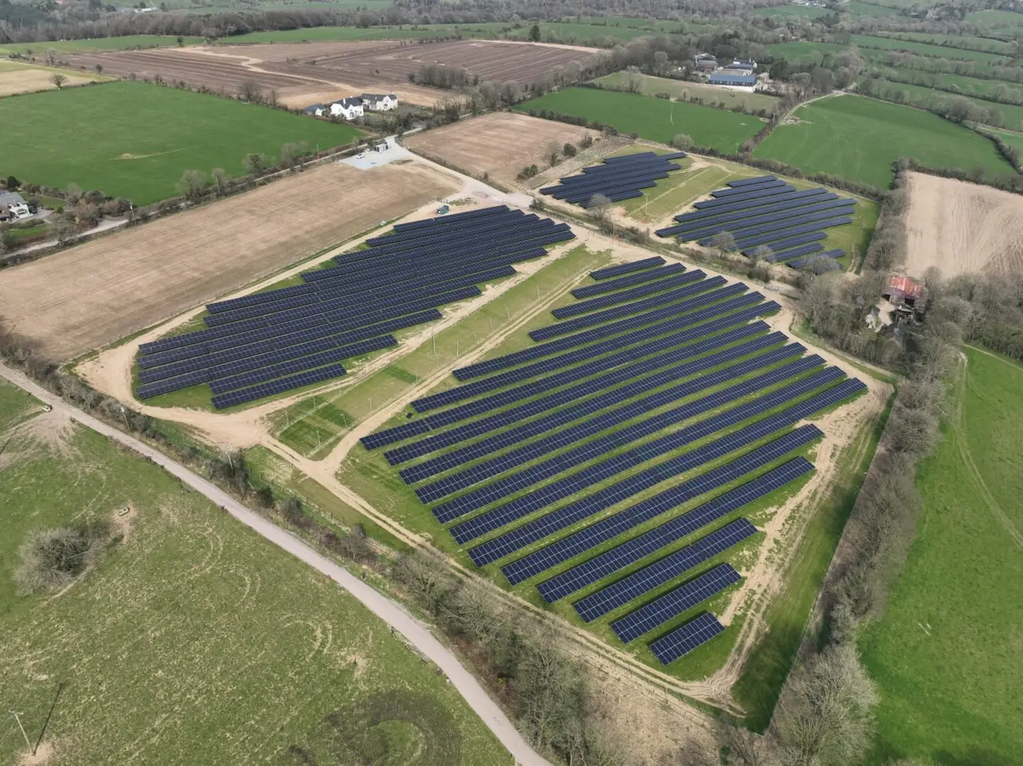
Solar Farm Thermal Survey
Client Stories
Trusted by Leading Irish Businesses
“Drone Solutions Ireland transformed how we track site progress. The weekly volumetric reports are incredibly accurate and our client presentations have never looked better.”
Seán Murphy
Site Manager, Collins Construction
Trusted by

Get Started Today
Ready to See Your Project from Above?
Book a free consultation. We'll assess your requirements, check airspace, and provide a detailed quote within 24 hours.